
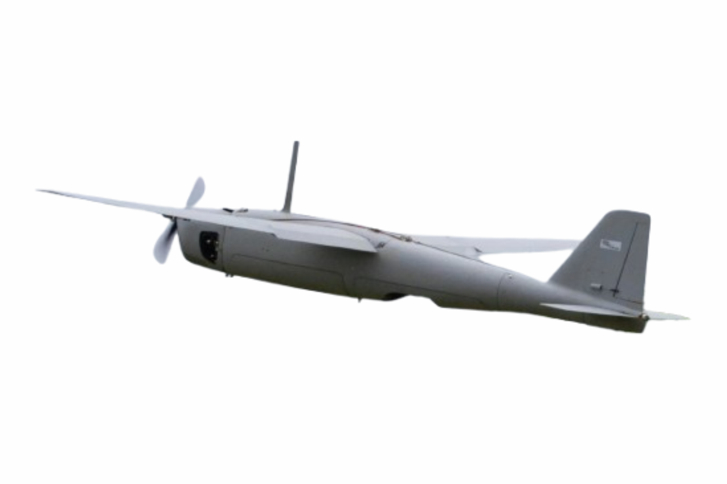
The UAV with the most technology OnBoard in the Latin-America
BRADRONE HARPIA is a brazilian produced, high-performance compact system that stands out for its modularity and effectiveness. In fact, it is a multifunctional complex using a UAV platform. It can be used for long-range monitoring, surveillance of areas dominated by criminal factions, forest and environmental monitoring to prevent wildfires, land grabbing and deforestation. It can also be used for border patrols to prevent smuggling, and search and rescue operations due to its ability to detect cellphones by their coordinates.
Launching System
The Launching System allows the use in any terrain, including flooded areas. This type of lauching reduces the drone’s weight, increasing its autonomy and range.
The BRADRONE HARPIA allows for a wide range of payloads to meet various needs, allowing its use in situations that require the real-time monitoring.
Landing
The BRADRONE HARPIA’s landing is performed by parachutes and airbags activated when the UAV reach a ideal height for it.
That makes a perfect and safety landing in a determinated area.

ANAC and ANATEL Certified
HARPIA is the private enterprise UAV with the greatest range and flight altitude ever certified by ANAC, brazilian authority agency that regulates and inspect civil aviation activities.
It’s also, certified by ANATEL, brazilian telecommunications agency.

Strategic Defense Product
HARPIA is the First and only UAV of its category certified by the Brazilian Ministry of Defense as a “Strategic Defense Product”, making AdTech SD a brazilian “Defense Company”.

Mobile Link
In addition to its main Station, the UAV Harpia allows access via a mobile link, so that an operator can access monitoring data remotely from the Control Station.
It has easy assembly that allows adaptation and use in vehicles, boats or even handled by an operator on foot.
Agricultural Use
Georeferenced survey
We offer location and identification services through known geographical coordinates of any object or natural obstacle on the earth’s surface.
By using the modern Harpia to fly over a predetermined route and having an advanced map composition software, the operator is capable of conducting precise topographical surveys of extensive areas, presenting detailed images and exact locations of natural accidents and objects of interest within the mapped region.
Employment in precision agriculture. The use of drones has resulted in increased precision and reduces the likelihood of errors in agriculture. With the use of drones and specific software, experts can guarantee higher agricultural yields through soil analysis, fertilizer application, area productivity analysis, identification of possible pests, and guidance for planning sowing and harvesting. In agriculture, drones are used for more precise monitoring and development of crops, showing their needs and resulting in higher productivity. Different cameras can be used to obtain hyperspectral and multispectral images.
Private Security
Aerial Filming and Photographic Surveying
Our team has state-of-the-art photo and filming equipment, as well as qualified personnel to ensure high-quality photos and videos. AdTech guarantees the best work, fully prepared to meet advertising demands, property control, assessment of damages, or any other purpose. Our professionals are capable of providing services anywhere in the national territory, always observing the regulation of Brazilian Aviation Agency (ANAC and DCEA).
Property security and escorts in monitored Movements
Being a fixed-wing drone for long-range flights, with sophisticated cameras, HARPIA can perform computer-controlled flight, capable of perfect monitoring of ground convoys for hundreds of kilometers, and can replace the use of personnel in risk functions.
With personnel trained in drone operation in the security sector, and with the use of technologically well-designed equipment for use in private and corporate security, AdTech guarantees total effectiveness in property control and escort missions. Our company offers different models of cameras (day and night), and has software developed for each type of surveillance mission.